Weather-US
  • My Account My account / Settings
    • Your subscription options
    • Ad-free
    • Plus (with extra features) Plus
    • Business (with extra features) Plus
    • Account
    • Log in
    • Registration
    • Settings
  • Forecast
    • Weather overview
    • Forecasts
    • Meteograms
    • 14 day forecast
    • Forecast XL
    • Forecast Ensemble
    • Forecast Ensemble Heatmaps Plus
    • Long range forecast
    • 46 days forecast (ECMWF) Plus
    • Forecast 7 months (ECMWF) Plus
    • Additional
    • Wave models
    • Tropical cyclone tracks (ECMWF/Ensemble)
    • Aurora forecast
    • Astronomy
    • Air quality
    • Model charts
    • North America
    • CONUS Swiss HD 4x4 (24 hours) new
    • NAM CONUS (60 hours)
    • HRRR (18 hours)
    • RPDS (80 Stunden)
    • HRPDS (24 hours)
    • Global
    • ECMWF 6z/18z (3 days) Plus
    • ECMWF IFS HRES 0z/12z (10 days)
    • ECMWF AIFS (15 days) new
    • Multi Model (10 days)
    • UKMO (7 days)
    • ICON (7 days)
    • GFS 0.125° (6 days)
    • GFS (15 days)
    • ARPEGE (5 days)
    • GEM (10 days)
    • ACCESS-G (10 days)
    • CMA (10 days)
    • GDAPS/UM (12 days)
    • JMA (10 days)
    • Europe
    • Central Europe Super HD (3 days)
    • Central Europe Super HD (MOS) (3 days)
    • Swiss-MRF (10 days)
    • ICON-D2 (2 days)
    • AROME (2 days)
    • AROME-PI (6 hours)
    • HARMONIE (2 days)
    • Central Europe Multi Model HD (3 days)
    • Europe Swiss HD 4x4 (3 days)
    • Europe Swiss HD Nowcast (1 day)
    • ECMWFbase Swiss HD 4x4 (2 days)
    • ICON-EU (5 days)
    • ICON-EU Flash (1 day)
    • EURO-4 (2 days)
    • HARMONIE DMI (2 days)
    • ICON-CH1 (1 day) new
    • ICON-CH2 (5 days) new
    • Britain HD 2km (3 days)
    • Europa Finnish HD HARMONIE (3 days)
    • RUSSIA (3 days)
  • Forecast
      • Forecasts
        • Weather overview (Next hours and days, 14 day forecast)
        • Meteograms (Graph 3-15 days - choose your model)
        • 14 day forecast (ECMWF-IFS/EPS, graphs with ranges)
        • Forecast XL (Graph and table up to 15 days - choose your model)
        • Forecast Ensemble (Up to 7 models, multiple runs, graph up to 46 days)
        • Forecast Ensemble Heatmaps (Up to 7 models, multiple runs, graph up to 46 days) Plus
      • Long range forecast
        • 46 days forecast (ECMWF) Plus
        • Forecast 7 months (ECMWF) Plus
      • Additional
        • Wave models
        • Storm Tracks (ECMWF/Ensemble)
        • Aurora forecast
        • Air quality
        • Astronomy
    • Model charts
      • Global
        • ECMWF 6z/18z Plus
        • ECMWF IFS HRES 0z/12z
        • ECMWF AIFS new
        • Multi Model
        • UKMO
        • ICON
        • GFS 0.125°
        • GFS
        • ARPEGE
        • GEM
        • ACCESS-G
        • CMA
        • GDAPS/UM
        • JMA
      • Europe
        • Central Europe Super HD
        • Central Europe Super HD (MOS)
        • ICON-D2
        • ICON-RUC new
        • AROME
        • AROME-PI
        • HARMONIE
        • Central Europe Multi Model HD
        • Europe Swiss HD 4x4
        • Europe Swiss HD Nowcast
        • ECMWFbase Swiss HD 4x4
        • Swiss-MRF
        • ICON-EU
        • ICON-EU Flash
        • HARMONIE DMI
        • ICON-CH1 new
        • ICON-CH2 new
        • UKMO UK
        • HARMONIE FMI
      • North America
        • CONUS Swiss HD 4x4
        • NAM CONUS
        • HRRR
        • RPDS
        • HRPDS
  • Observations
    • Weather stations (main network)
    • Radiosonde
  • Observations
    • Weather stations
      • Observations
        • Weather observation
        • Visibility
      • Temperatures
        • Temperature
        • Temperature, 10min
        • Max. temperature, 12h
        • Min. temperature, 12h
      • Humidity
        • Relative humidity
        • Dew point
        • Dew point spread
      • Wind speed
        • Wind direction
        • Wind speed, 10min average
        • Gusts, 10min
        • Gusts, 1h
      • Precipitation
        • Precipitation total, 1h
        • Precipitation total, 3h
        • Precipitation total, 6h
        • Precipitation total, 24h
      • Clouds
        • Cloud base
        • Cloud coverage
        • Cloud types, low clouds
        • Cloud types, middle clouds
        • Cloud types, high clouds
      • Pressure
        • Sea level pressure, QFF
        • Sea level pressure, QNH
        • Air pressure at station
        • Pressure tendency, 3h
      • Snow
        • Snow depth
        • Fresh snow, 12h
        • Fresh snow, 24h
      • Water
        • Water temperature
        • Wave heights
  • Radar & LightningRadar & LightningRadar
      • US Doppler Radar (HD)
        • Base reflectivity (with archive since 1991)
        • Storm tracking
        • Vertically Integrated Liquid
        • Echo Tops
      • Lightning detection
        • Lightning analysis
        • Lightning detection worldwide
        • Lightning CG worldwide (since 2004) Plus
        •  
      • Precipitation total
        • Precipitation total (Radar), 1h
        • Precipitation total (Radar), 6h
        • Precipitation total (Radar), 24h
        • Precipitation total (Radar), 72h
        • Precipitation total (Sat) worldwide
      • Radar (other countries)
        • Radar Europe
        • Radar Germany
        • Radar Switzerland
        • Radar Austria
        • Radar Netherlands
        • Radar Sweden
        • Radar Spain
  • Radar & Lightning
    • US Doppler Radar (HD)
    • Base reflectivity
    • Storm tracking
    • Vertically Integrated Liquid
    • Echo Tops
    • Lightning detection
    • Lightning analysis
    • Lightning detection worldwide
    • Lightning CG worldwide Plus
    • Precipitation total
    • Precipitation total (Radar), 1h
    • Precipitation total (Radar), 6h
    • Precipitation total (Radar), 24h
    • Precipitation total (Radar), 72h
    • Precipitation total (Sat) worldwide
    • Radar (other countries)
    • Radar Europe
    • Radar Germany
    • Radar Switzerland
    • Radar Austria
    • Radar Netherlands
    • Radar Sweden
    • Radar Spain
  • Satellite imagesSat images
      • GOES-16 (day and night)
        • Infrared Super HD
        • Top Alert Super HD
        • Water Vapor Super HD
      • GOES-16 (day only)
        • Satellite Super HD
        • Satellite color Super HD
        • Smoke-Check Super HD
    • Entire Globe
      • North and South America
        • Infrared (day and night)
        • Cloud Tops Alert (day and night)
        • Water Vapor (day and night)
        • Satellite Super HD (day only)
        • Satellite visible (day only)
      • Europe and Africa
        • Infrared (day and night)
        • Cloud Tops Alert (day and night)
        • Water Vapor (day and night)
        • Satellite HD (day only)
        • Archive since 1981 (once a day)
      • Asia and Australia
        • Satellite HD (day only)
        • Cloud Tops Alert (day and night)
        • Water Vapor (day and night)
        • Volcano Alert (day and night)
        • Fog-Check (night only)
      • Australia and Americas
        • Infrared (day and night)
        • Cloud Tops Alert (day and night)
        • Water Vapor (day and night)
        • Satellite HD (day only)
        • Satellite visible (day only)
  • Satellite images
    • USA
    • Infrared Super HD (day and night)
    • Top Alert Super HD (day and night)
    • Water Vapor Super HD (day and night)
    • Satellite Super HD (day only)
    • Satellite color Super HD (day only)
    • Smoke-Check Super HD (day only)
    • North and South America
    • Infrared (day and night)
    • Cloud Tops Alert (day and night)
    • Water Vapor (day and night)
    • Satellite Super HD (day only)
    • Satellite visible (day only)
    • Europe and Africa
    • Infrared (day and night)
    • Cloud Tops Alert (day and night)
    • Water Vapor (day and night)
    • Satellite HD (day only)
    • Archive since 1981 (once a day)
    • Asia and Australia
    • Satellite HD (day and night)
    • Cloud Tops Alert (day and night)
    • Water Vapor (day and night)
    • Volcano Alert (day and night)
    • Fog-Check (night only)
    • Australia and Americas
    • Infrared (day and night)
    • Cloud Tops Alert (day and night)
    • Water Vapor (day and night)
    • Satellite HD (day only)
    • Satellite visible (day only)
    • Entire Globe
  • Climate
      • Observations
        • Climate-Portal
        • Weather stations (main network)
      • Reanalysis
        • ECMWF ERA5 (from 1950)
        • CONUS NCAR (1979 - 2020) new
  • Climate
    • Reanalysis
    • ECMWF ERA5 weather maps (from 1950)
    • CONUS NCAR (1979 - 2020) new
    • Climate-Portal
    • Historical observations
    • Observations (main network)
  • Energy Weather Tools
  • More
      • 360° panorama webcams
        • Sonnenbuehl/Alb (Germany)
        • Klingenstock (Switzerland)
        • Sattel (Switzerland)
        • Luxembourg City (Luxembourg)
        • Rodange (Luxembourg)
        • Weiswampach (Luxembourg)
        • Oklahoma City (WeatherOK, USA)
        • Omega OK (WeatherOK HQ, USA)
        • Watonga OK (WeatherOK, USA)
        • Lake Murray, Ardmore OK (WeatherOK, USA)
        • Death Valley (WeatherOK, USA)
      • Information
        • Deactivate ads
        • Weather API
      • Corona virus
        • Official COVID19 cases (Archive)
        • Official COVID19 deaths (Archive)
      • Scientific Research
        • Cityclim.eu
        • AVOSS
  • More
    • Information
    • Deactivate ads
    • Weather API
    • Corona virus
    • Official COVID19 cases (Archive)
    • Official COVID19 deaths (Archive)
    • 360° panorama webcams
    • Sonnenbuehl/Alb (Germany)
    • Klingenstock (Switzerland)
    • Sattel (Switzerland)
    • Luxembourg City (Luxembourg)
    • Rodange (Luxembourg
    • Weiswampach (Luxembourg)
    • Oklahoma City (WeatherOK, USA)
    • Omega OK (WeatherOK HQ, USA)
    • Watonga OK (WeatherOK, USA)
    • Lake Murray, Ardmore OK (WeatherOK, USA)
    • Death Valley (WeatherOK, USA)
    • Scientific Research
    • Cityclim.eu
    • AVOSS
  • My Account My account / Settings
    • Your subscription options
    • Ad-free
    • Plus (with extra features) Plus
    • Business (with extra features) Plus
    • Account
    • Log in
    • Registration
    • Settings
NOTICE Tap on the black bar above to open our additional menu which allows you to navigate directly to your desired information.
Don't show this message again
No advertising, more exclusive weather content:
click here!

Weather forecastForecast
Model comparison XL

Mór

Fejér, Hungary

Weather Mór
Next 3-5 days
14 day forecast
Next 2-3 days
Next 16 days
ICON-D2 EPS (2 days)
ICON-EU EPS (5 days)
ICON EPS (5 days)
ECMWF EPS (15 days)
GEFS (16 days)
GEPS (15 Tage)
ECMWF EPS (46 days) Plus
Heatmaps (all ensemble models) Plus
Europe Swiss HD Nowcast
Central Europe Multi Model HD
ICON-EU
Europe Swiss HD 4x4
ECMWFbase Swiss HD 4x4
HIRLAM-KMNI
Swiss-MRF
Multi Model
ECMWF IFS HRES 0z/12z
ECMWF 6z/18z Plus
GFS
ICON
UKMO
ACCESS-G
GEM
GDAPS/UM
CMA
ARPEGE
GFS 0.125
JMA
Forecast menue

Mór

Fejér, Hungary

Weather Mór
Next 3-5 days
14 day forecast
Next 2-3 days
Next 16 days
ICON-D2 EPS (2 days)
ICON-EU EPS (5 days)
ICON EPS (5 days)
ECMWF EPS (15 days)
GEFS (16 days)
GEPS (15 Tage)
ECMWF EPS (46 days) Plus
Heatmaps (all ensemble models) Plus
Europe Swiss HD Nowcast
Central Europe Multi Model HD
ICON-EU
Europe Swiss HD 4x4
ECMWFbase Swiss HD 4x4
HIRLAM-KMNI
Swiss-MRF
Multi Model
ECMWF IFS HRES 0z/12z
ECMWF 6z/18z Plus
GFS
ICON
UKMO
ACCESS-G
GEM
GDAPS/UM
CMA
ARPEGE
GFS 0.125
JMA

Mór

Fejér, Hungary

Forecast XL (model comparison) for Mór
Loading forecast chart

Loading weather forecast
All times in forecast are in local time All times are local time (CEST)
Loading forecast

Loading weather forecast

Forecast XL (multi-model)

This product displays data from several weather models for a given location. Because all the model data is displayed in one location, this product makes comparison easy. No one model is likely to get a forecast exactly right, especially 5-10 days out, but you can use this product to get an idea of general trends. If the majority of models are forecasting warmer temps in the 5-10 day period, you can reasonably expect warmer weather in the forecast even without paying too much attention to the individual highs/lows that may or may not be accurate.

You can also use this product to get an idea of the confidence models have in the forecast. If all the model lines are close together, that means that there is very little disagreement and you can have high confidence in the forecast. The opposite is also true and if you see the model lines diverge, that means the various models disagree with each other and thus the forecast becomes more uncertain.
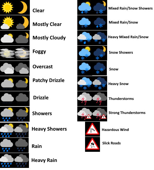
Forecast symbols

Forecast symbols

Error message

Error

User settings

Wettermeldung

My locations
Loading...

Your current country selection

weatherdotus
@WeatherdotUS
iOS & Android apps   Weather API
Terms and Conditions
  Privacy
  Privacy-Manager
  Contact
  Imprint
 

© 2025 Kachelmann GmbH